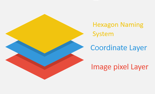
The Battlefield map has 3 layers.
The top layer is a GIS layer.
The top layer identifies GIS (Geographic Information System) points, lines and polygons. Hexagons are used for unit placement and use a hexagon naming system. Staging areas and elimination trays show up as rectangles and circles on the map. Terrain features are located inside a hexagon or near the hexside on the map.
The middle layer is a HexagonGrid cartesian coordinate system.
Analytic geometry calculations use the HexagonGrid cartesian coordinate system. Unit placement, line of sight and lines of communications are examples of using geometry for analysis. How to draw a hexagon map using the cartesian coordinate system.
The bottom layer is a map image file.
Geocoding
Geocoding is the process of converting human-readable addresses and place names into geographic coordinates (latitude and longitude). Hexagons on the hexagon grid have location names. All of these elements need to be converted to a reference geographic coordinate.
Reverse Geocoding
The reverse of this geocoding process is reverse geocoding, which converts grid coordinates into a readable address. Hexagons are give a location name. e.g. 0201 or G-4
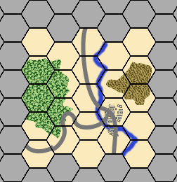
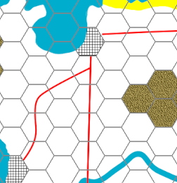
For example, when a mouse over event occurs on the map below at hexagon 0201, the second layer identifies the hexagon with a center at (90,80) pixels. The second layer calculates the (12,20) grid coordinate. The third layer reverse geocodes a grid name of 0201.Click here to show how to detecting polygons for wargame calculations
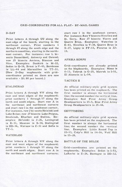
Grid Naming Systems - reverse geocoding hexagons
Two examples - Standard 0101 & Blitzkrieg
Other Examples of hexagon naming systems
- flat 0101: Battle For Moscow
Click to read Avalon Hill experimental coordinate systems.
- flat A01(240°): 1914
- flat A-01(240°): Blitzkrieg
- flat A-01(240°): D-Day
- flat A-01(300°) Battle Of The Bulge
- flat A01(60°): Stalingrad
- pointy A-01(240°): Africa Korps
- pointy A01(240°): Waterloo