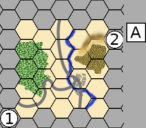
Detecting points, lines and polygons
Grid coordinates are calculated for wargame map features.
- Hexagons are used for unit placement.
- Circles and rectangles can represent staging areas or elimination boxes.
- Hexagons, hexsides and hexagon edges are used to record terrain data types.
- Hexagons and hexsides are used to analyze line of sight and lines of communication.
Grid coordinates are used to draw graphics on the wargame map.
- How to draw a hexagon map using the cartesian coordinate system
with different hexagon naming systems.
Calculating grid coordinates
- Hexagons are referenced by the center coordinate,
which can be converted to the wargame hexagon naming system.
- Hexsides are referenced by the hexside line's center.
- Hexagon edges are referenced by the hexagon edge triangle coordinate.